

Ocean depth map
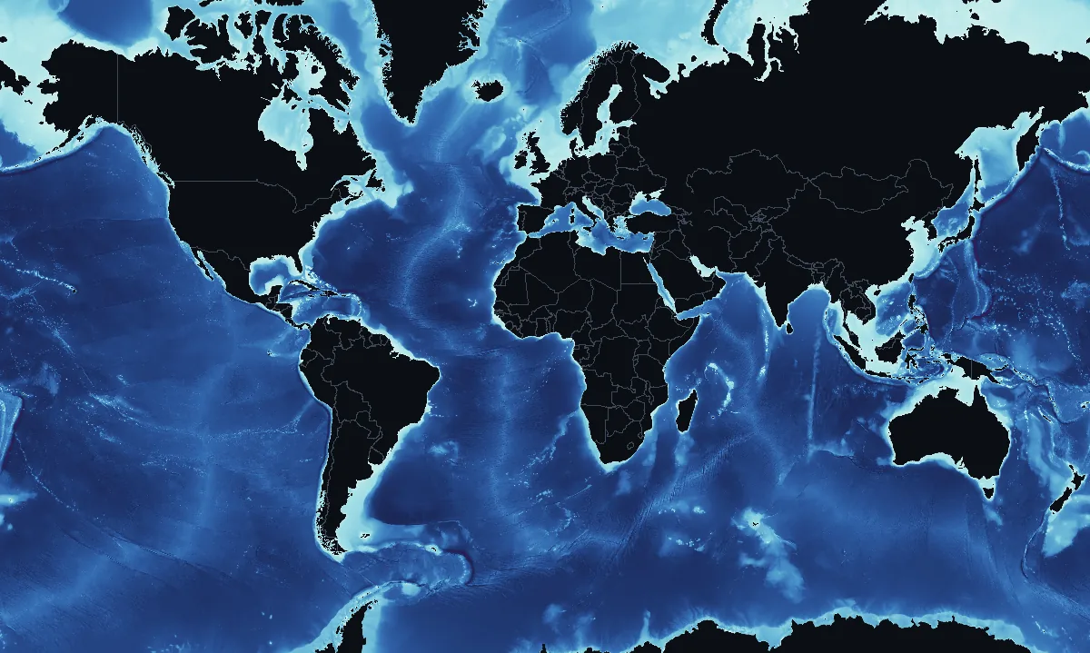
How deep the sea is, from the shallow continental shelves to trenches nearly 11,000 m36,000 ft down, from NOAA's ETOPO 2022 model of the Earth's surface. The sea floor hardly changes, so this map is drawn once.
Open the interactive depth map
How much of the ocean lies at each depth
| Depth | Share of the ocean | What is there |
|---|---|---|
| 0–200 m0–656 ft | 7% | Continental shelves and shallow seas |
| 200–1,000 m656–3,281 ft | 4% | The upper continental slopes, and the tops of ridges and seamounts |
| 1,000–3,000 m3,281–9,843 ft | 13% | Continental slopes, mid-ocean ridges and seamounts |
| 3,000–6,000 m9,843–19,685 ft | 75% | The abyssal plains and the flanks of the mid-ocean ridges |
| below 6,000 m19,685 ft | 1.0% | Ocean trenches, the hadal zone |
How the shares are measured
Shares of the ocean's area, every sea cell of the map weighted by its size, from NOAA ETOPO 2022 averaged over cells of about 3.7 km2.3 mi.
Famous places in the deep
| Place | Depth | On this map | Why it is known |
|---|---|---|---|
| Challenger Deep | about 10,925 m35,800 ft | 10,204 m33,478 ft | 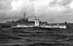 The deepest known place in the ocean, at the southern end of the Mariana Trench. The bathyscaphe Trieste first reached the bottom in 1960. |
| Horizon Deep | about 10,816 m35,500 ft | 10,688 m35,066 ft | 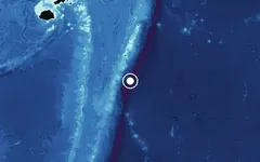 The second-deepest point in the Pacific, and so in the whole ocean, at the bottom of the Tonga Trench. A submersible dive to the spot confirmed the depth measured by sonar. |
| Puerto Rico Trench | about 8,408 m27,600 ft | 8,402 m27,566 ft | 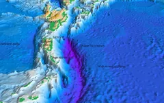 The deepest place in the Atlantic Ocean, north of Puerto Rico. |
| Java Trench | about 7,290 m23,900 ft | 7,034 m23,077 ft | 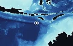 The deepest place in the Indian Ocean, in the trench that runs south of Indonesia. |
| South Sandwich Trench | about 7,385 m24,200 ft | 7,248 m23,780 ft | 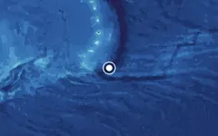 The deepest place in the Southern Ocean, at the southern end of the South Sandwich Trench. |
| Molloy Hole | about 5,669 m18,600 ft | 5,556 m18,228 ft | 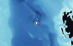 The deepest place in the Arctic Ocean, in the Fram Strait between Greenland and Svalbard. |
| Titanic | about 3,800 m12,500 ft | 3,805 m12,484 ft | 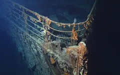 RMS Titanic sank on 15 April 1912 after striking an iceberg. Her wreck was found in 1985, about 600 km370 mi south-southeast of Newfoundland. |
| Bismarck | about 4,790 m15,700 ft | — | 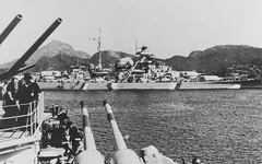 The German battleship sunk on 27 May 1941, found by Robert Ballard's team in 1989. Marked where she sank: the wreck's exact position has not been published. |
| HMS Hood | about 2,800 m9,190 ft | — | 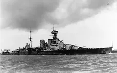 The Royal Navy battlecruiser sank in the Denmark Strait on 24 May 1941 in battle with the Bismarck and the Prinz Eugen; 1,415 men were lost and only 3 survived. David Mearns's team found the wreck on 19 July 2001. Its exact position is not released, so the marker is approximate. |
| Endurance | about 3,008 m9,870 ft | — | 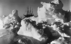 Ernest Shackleton's ship, crushed by the sea ice in 1915 and found in 2022, upright and well preserved. Marked near where she sank. |
| USS Samuel B. Roberts | about 6,895 m22,600 ft | — | 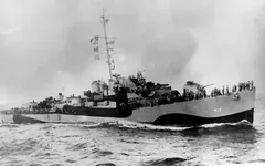 The deepest shipwreck ever found: a U.S. destroyer escort sunk in the Battle off Samar on 25 October 1944, found in 2022. Its exact position is kept secret as a war grave, so the marker is approximate. |
| USS Monitor | about 70 m230 ft | 58 m190 ft | 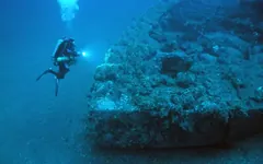 The Union Navy's Civil War ironclad sank on New Year's Eve 1862, about 26 km16 mi south-southeast of the Cape Hatteras Lighthouse, with 16 of her sailors. Found in 1973, the wreck became the first U.S. national marine sanctuary in 1975. |
| U-166 | about 1,520 m5,000 ft | — | 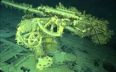 The only German U-boat sunk in the Gulf of Mexico: depth charges from the escort PC-566 sank her on 30 July 1942, after she had sunk the passenger ship Robert E. Lee, and all her crew were lost. Found in 2001 within 1.6 km1 mi of the Robert E. Lee. Her position is withheld as a war grave, so the marker is approximate. |
| Iceland | — | — | 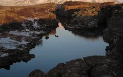 Where the Mid-Atlantic Ridge, the seam along which the North American and Eurasian plates pull apart, rises above the sea. |
| Mauna Kea | — | — | 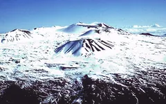 Measured from its base on the sea floor, about 6,000 m19,700 ft down, Mauna Kea rises about 10,200 m33,500 ft, more than Mount Everest. Its summit is 4,205 m13,796 ft above sea level. |
| Point Nemo | — | 3,522 m11,555 ft |  The place in the ocean farthest from land: about 2,688 km1,670 mi from the nearest islands, Ducie Island to the north, Motu Nui off Easter Island to the northeast and Maher Island in Antarctica to the south. Named after Captain Nemo of Jules Verne's Twenty Thousand Leagues Under the Sea. |
| Lost City | about 800 m2,620 ft | — | 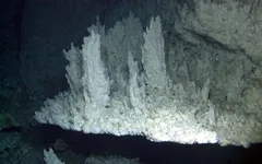 A field of hydrothermal vents found in December 2000 near the summit of the Atlantis Massif, 15 km9 mi west of the Mid-Atlantic Ridge's spreading axis. Its largest carbonate tower, Poseidon, is 60 m197 ft tall, and the field has been active for at least 30,000 years. |
| Monterey Canyon | about 4,000 m13,100 ft | — | 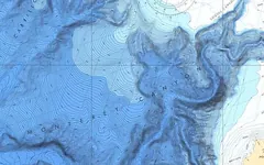 A submarine canyon that MBARI says rivals the Grand Canyon in size. Its main channel winds more than 400 km250 mi out to sea, its walls rise up to 1,700 m5,600 ft, and it ends on the abyssal plain about 4,000 m13,100 ft down. |
| Endeavour Hydrothermal Vents | about 2,250 m7,380 ft | — | 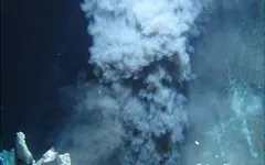 Hydrothermal vents found in 1982, about 250 km155 mi southwest of Vancouver Island, home to 12 species that live nowhere else. In 2003 they became Canada's first Marine Protected Area under the Oceans Act; since 2024 they are protected within the larger Tang.ɢ̱wan – ḥačxwiqak – Tsig̱is MPA. |
Sources and photo credits
Sources: Challenger Deep, Puerto Rico Trench, Java Trench, South Sandwich Trench, Molloy Hole: Stewart and Jamieson (2019), Earth-Science Reviews 197, 102896; Horizon Deep: Bongiovanni, Stewart and Jamieson (2021), Geoscience Data Journal; Titanic, Iceland: NOAA Ocean Exploration; Bismarck: the 1989 survey that found the wreck; HMS Hood: HMS Hood Association and the National Museum of the Royal Navy; Endurance: Falklands Maritime Heritage Trust (Endurance22, 2022); USS Samuel B. Roberts: U.S. Navy (2022); USS Monitor: NOAA Monitor National Marine Sanctuary; U-166: Bureau of Safety and Environmental Enforcement and NOAA Ocean Exploration; Mauna Kea: U.S. Geological Survey; Point Nemo: NOAA Ocean Service; Lost City: Kelley and others (2005), Oceanography 18(3); Monterey Canyon: MBARI (Monterey Bay Aquarium Research Institute) and the U.S. Geological Survey; Endeavour Hydrothermal Vents: Fisheries and Oceans Canada. Photos, all public domain or CC0 (on the interactive map each place's photos can be browsed): Challenger Deep: U.S. Navy (NH 96797, 1960); Puerto Rico Trench: U.S. Geological Survey (2005); Titanic: NOAA, Institute for Exploration and University of Rhode Island (2004) · Francis Godolphin Osbourne Stuart (1912); Bismarck: Paul S. Schmalenbach, U.S. Naval History and Heritage Command (1941); HMS Hood: Wright & Logan, U.S. Naval History and Heritage Command (1931-32) · U.S. Navy, Naval History and Heritage Command (1924); Endurance: Frank Hurley, National Library of Australia (1915) · Frank Hurley, State Library of New South Wales (1915) · Frank Hurley, State Library of Queensland (1915); USS Samuel B. Roberts: U.S. Navy photo NH 96011, Naval History and Heritage Command (1944) · U.S. Navy photo NH 90603, Naval History and Heritage Command (1944); USS Monitor: NOAA Monitor National Marine Sanctuary collection · NOAA Monitor National Marine Sanctuary collection (1862); U-166: NOAA Maritime Heritage Program (LCDR Jeremy Weirich, NOAA Corps); Iceland: cogdogblog (2008, CC0); Mauna Kea: U.S. Geological Survey; Lost City: National Science Foundation, University of Washington and Woods Hole Oceanographic Institution (2000); Monterey Canyon: NOAA (1989); Endeavour Hydrothermal Vents: NOAA (2009). Horizon Deep, Java Trench, South Sandwich Trench, Molloy Hole and Point Nemo have no free photo, so they are shown on our own depth map. The map's reading is the average over a cell about 3.7 km2.3 mi across, so at the bottom of a narrow trench it is shallower than the deepest sounding. Places without a published position are marked where they sank or near where they lie, with no map reading.
What the map shows
The colours are the depth of the sea floor below sea level: pale green and cyan on the shallow continental shelves along the coasts, blues growing darker with depth, and violet in the deep trenches. Thin darker lines, the isobaths, join places of equal depth every 1,000 m3,281 ft. The colour scale is stretched at the shallow end, so the shelves and the slopes that drop from them get as much room on the legend as the deep sea.
Three quarters of the ocean is between 3,000 and 6,000 m (9,800 and 19,700 ft) deep, the dark blue abyssal plains. Running through them are the mid-ocean ridges, which show as lighter bands down the middle of the Atlantic and across the Pacific and Indian Oceans: together the longest mountain range on Earth, about 65,000 km40,390 mi long, nearly all of it under water. The deepest places are the trenches, mostly along the edges of the Pacific, where the sea floor reaches nearly 11,000 m36,000 ft in the Challenger Deep of the Mariana Trench.
How to read the map
Tap or click the sea on the interactive map for the depth at that point, in metres or feet. With a mouse, the depth under the pointer shows as you move over the picture; it is read from the colour, so it is only approximate. Each depth is the average over a cell about 3.7 km2.3 mi across, so the bottom of a narrow trench, or the top of a steep seamount, reads less extreme than the deepest or shallowest sounding there.
Where the numbers come from
NOAA's ETOPO 2022 global relief model gives the height of the land and the depth of the sea floor on a grid of 60 arc-seconds, about 1.85 km1.15 mi; this map averages it over cells of 2 arc-minutes, about 3.7 km2.3 mi. Much of the deep sea floor has never been surveyed by ship, and there its depth is estimated from satellite measurements of the sea surface, so small features can be missing. The map is not for navigation: sailors use official nautical charts.